In 1800, Indiana Territory was formed from the Northwest Territory. Indiana Territory then encompassed what is now all of Indiana, Illinois, and parts of Michigan, Wisconsin and Minnesota starting from 1800 until 1805 when the Michigan Territory was formed and again the territory changed in 1809 when Illinois Territory was formed. The parts of Wisconsin and Minnesota were then a part of the Illinois Territory.
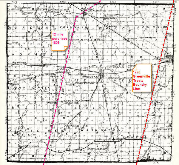
1809 also brought another change to Randolph County. It was called the 12 Mile Purchase. The pink line (This map is from 1880) shows this new boundary of open area to purchase land and settle.
This map is derived from a map published in the book “1882 History of Randolph County, Indiana” by E. Tucker with our compliments.
Connect